

The Satlink ELB3010 Manager software, which includes an interface specifically designed to manage ILL+ buoys, is very simple to use and includes all ttraditional radio buoy features. The included maps give clear visibility of the location of the echosounder buoys, while giving precise indication of the selected smart fishing device.
Order Now Request a quote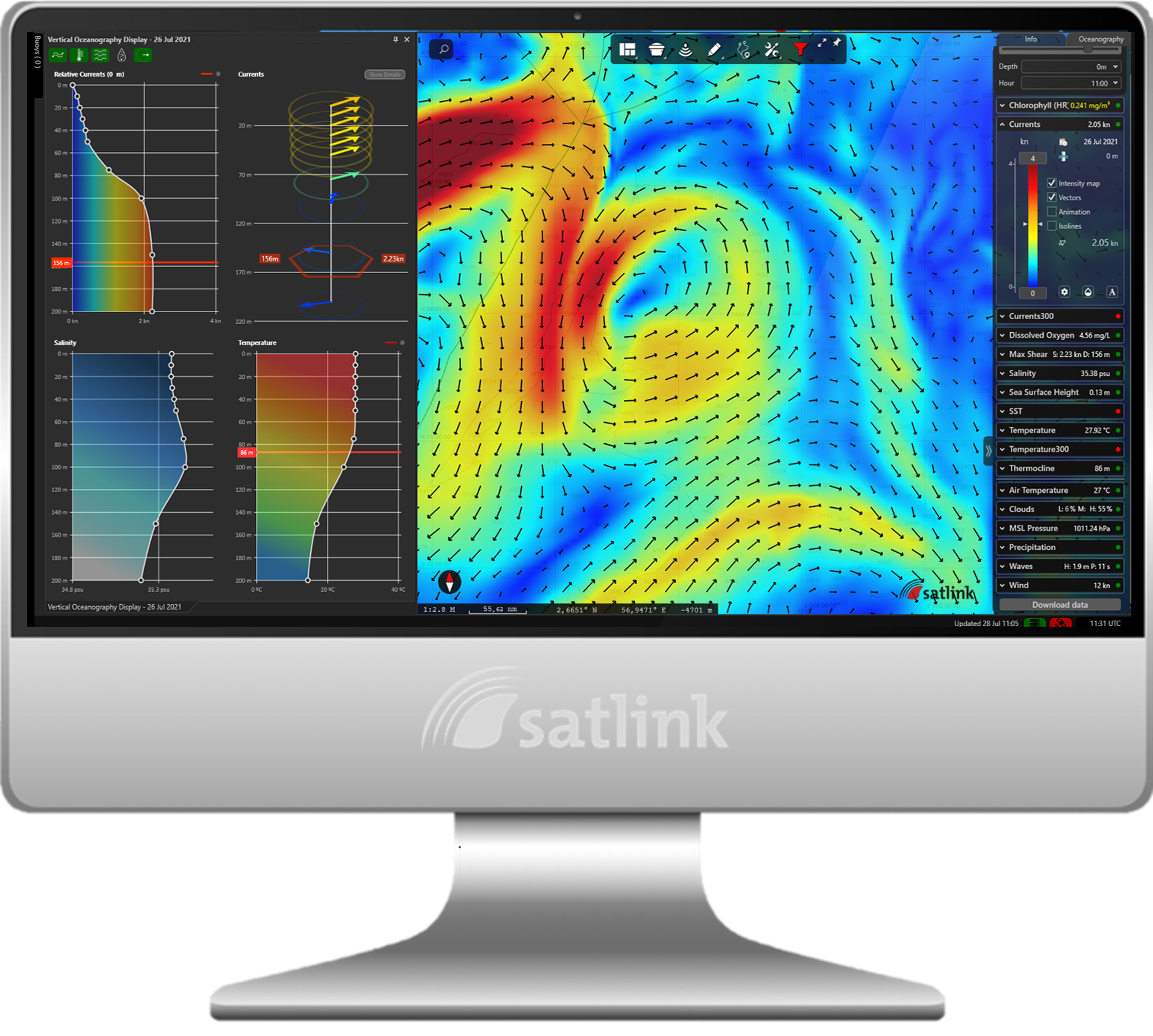
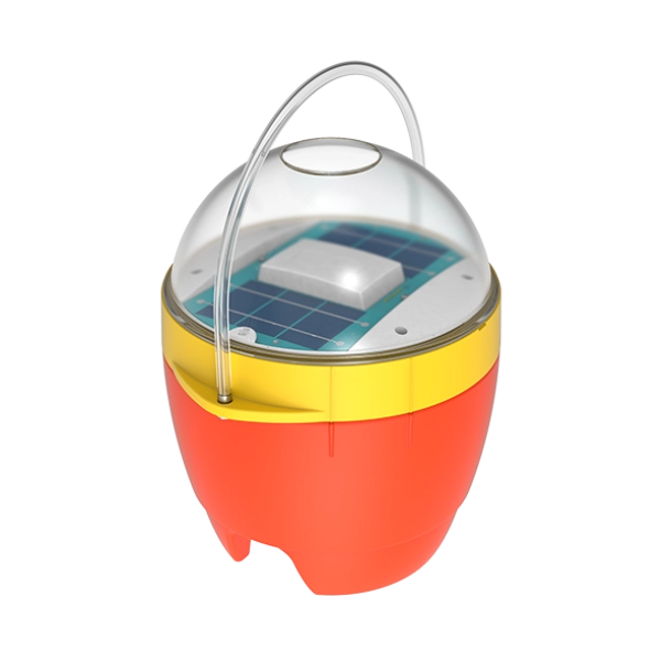
Solar Powered GPS Buoy
The ILL+ solar powered GPS buoy is fully autonomous; it uses a small array of solar panels to collect energy and transmit consistent and accurate GPS positions. Fishing gear and lines can always be located and tracked with no limitation on drift distance. Buoy GPS positions are received onboard the vessel's computer using Satlink's software program via email or an optional direct satellite connection antenna (IDP Communicator). The positions can also be copied to the owner’s office and/or sister ships. There is no need to purchase or replace batteries as the life of the solar powered energy system is nearly unlimited. Robust and lightweight, the ILL+ buoy is easy to use and fully compatible with Satlink’s Ocean Services data maps.
Additional Features
- Solar powered, no need to purchase extra charging equipment on board.
- Free advanced charting software that shows vessel and buoy GPS locations.
- The buoy’s design requires no maintenance and does not deteriorate over time.
- Optional IDP Communicator for a dedicated two-way link between vessel and buoys
- The transmitting interval of the buoys can be modified by the Captain.
- Buoy can be switched on remotely.
- Buoys require no maintenance, lifespan is only limited to environmental wear and tear.
- Water resistant to 11 Atmospheres (110 meters).
- Buoys are energy efficient and consume low amounts of power
- Buoy position and heading is always available; data is stored in secure servers
- Satlink buoys are environmentally friendly.
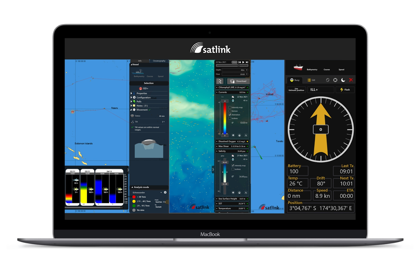
Satlink Buoy Management Software
Included with Satlink’s ILL+ Solar-powered GPS Tracking Longline Buoy is the “ELB Manager” a free and powerful chart plotting software program that is installed on the vessel’s computer to be used as a buoy visualization and management application.
This program controls all the information received from Satlink buoys and enables the
Captain to manage them in an intuitive, easy-to-use way with a simple display showing as much or as little of the environment data transmitted by the buoys in an unclutterway.
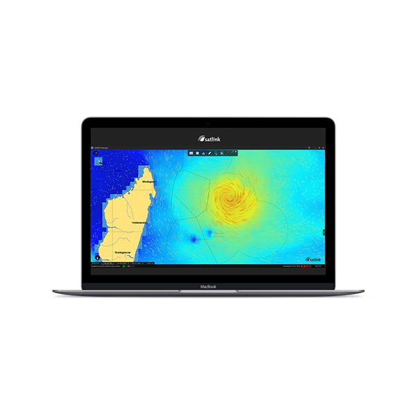
Powerful software features include; forecasting the buoys future drifting path. Determining if a buoy has broken free of the gear. Remotely turning on a light on the buoy for easy retrieval at night. Optional Oceanographic interface to turn on data which will overlay sea surface temperature, currents and plankton giving the Captain more insight of the fishing ground and potential ‘hot spots’.
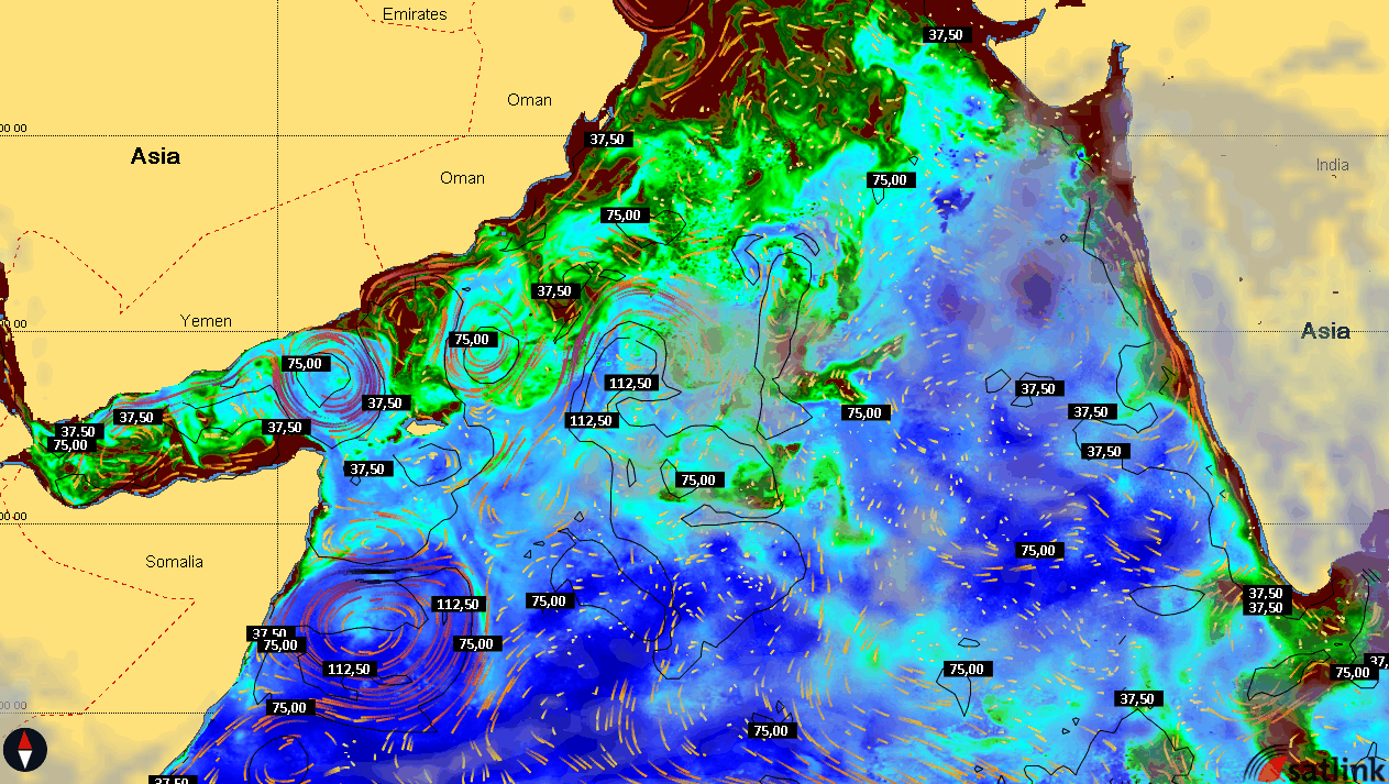
Satlink Oceanographic Service (SOS)
For the last 30 years, fishermen around the world have used various types of satellite oceanography information to help them locate good fishing zones or environments before they leave port.
Satlink now offers a new service called Satlink Oceanographic Service (SOS) that is available as an overlay in the ELB Manager which will show oceanographic data along with the vessel and its buoys and gear.
Satlink’s Oceanographic Service is based on models developed by Copernicus and NOAA, and uses the following parameters;
Based on the Sea surface temperature, ocean currents, current shear, chlorophyll, plankton, salinity, thermocline depth, dissolved oxygen, salinity, altimetry, air temperature, waves, wind, pressure, clouds and precipitation.
The maps can be custom ordered for your fishing area by the captain any day of the week. Once ordered, they are imported directly into the ELB Manager for viewing and analysis. Combined with the ILL+ buoy tracks, the ocean conditions provide valuable insight of the fishing grounds, near and far from the vessel.
- Shear: shear maps show the difference between the direction and intensity of the current at the surface of the water and at a certain depth*. This can help you identify the possible location of a strong cross-current, which will affect the movement of objects in the water. This map is particularly relevant for purse-seine vessels because, if an area has a very strong shear, it may be difficult to use nets.
- Chlorophyll: chlorophyll maps show where microscopic plant organisms are growing at the water's surface. This is a good indicator of where marine ecosystems are thriving. These plant organisms, known as phytoplankton, are at the bottom of the food chain. So, regions with a lot of phytoplankton also tend to have a diverse population of species.
- Currents: currents reflect the movement of ocean water from one zone to another. The richest fisheries are normally in areas where different currents meet and mix with each other because, in these areas, conditions tend to be optimal for supporting species diversity.
- Dissolved Oxygen: dissolved oxygen in the water is crucial for marine life and, combined with salinity and temperature, it defines biological diversity and water quality. Areas with low dissolved oxygen tend to have lower water quality and support a narrower variety of species.
- Salinity: salinity changes provide information on the location of influxes of freshwater, which often bring nutrients. Salinity also affects water density, which is key to studying ocean circulation.
- Altimetry: altimetry shows the height of the surface of the sea in relation to average sea level. Altimetry shows upwelling zones, where nutrients are brought to the surface by currents, and downwelling zones, where warmer water moves down towards the sea bed.
- Temperature: water temperature is a key factor in defining zones where different species of fish can thrive because each species can survive only between certain limits. Temperature differences also control ocean currents and they can provide an idea of the areas that are the richest in nutrients.
- Thermocline: the depth of the thermocline provides an idea of the depth of the epipelagic zone, where most marine species can be found. Changes in the depth of the thermocline also affect the behavior and distribution of fish, restricting them to certain depths.
-
This longline buoy has several benefits over traditional radio beacons or buoys:
- No batteries to buy, no maintenance
- No limitation on transmission distance
- Buoy positions can be shared with sister ships and home office
- There is no need to purchase charging stations or racks
- No long antenna that can break off
- Free chart plotting software, can add oceanographic charts
- Can be polled for immediate position or to turn on the light for nighttime recovery
- For shore manager, always a smartphone to access a password protected web site to view buoy positions
Request A Quote
Provide contact information and we'll reach out to start the process of working up a quote based on your specific requirements.